 |
|
|||||||||||||||||||||||
|
||||||||||||||||||||||||
|
|
||||||||||||||||||||||||
|
||||||||||||||||||||||||
|
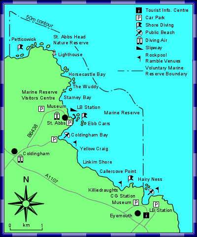
The Marine Reserve covers some 8 km of coastline from Hairy Ness, Eyemouth in the south to Thrummie Carr in the north, and extends offshore to the 50m-depth contour, an average distance of 1.5 km. The whole area covers 1030 hectares.
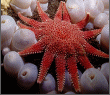
The coastline within the Marine Reserve is of outstanding natural beauty with mainly rocky shore backed by steep hard rock cliffs rising from 20m at the southern end to 90m at St. Abbs Head. There is a sandy beach at Coldingham Bay and a small fishing harbour at St. Abbs. Beneath the sea the rocky shore extends into rocky reefs down to approximately 15m where it then runs into cobble, pebbles and sand. There is a wide variety of underwater scenery with rock faces, caves, arches, surge gullies, boulder fields and shipwrecks. The variety of both flora and fauna is particularly rich and supports a commercial lobster and crab fisheries, and sustains one of the largest onshore seabird breeding colonies in the British Isles. The Biodiversity coupled with excellent underwater visibility attracts many Scuba divers who have easy access to excellent dive sites from the shore. The surrounding coastline is a major tourist attraction for holidaymakers, anglers, bird waters and walkers just to name a few.
|
|||||||||||||||||||||||
|
St. Abbs & Eyemouth Voluntary Marine Reserve. |
||||||||||||||||||||||||